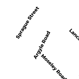
480 SPRAGUE ST
Owner Information
EB/GP3 480 SPRAGUE ST LLC
260 FRANKLIN ST 5TH FLR
BOSTON, MA 02110


Property Details
480 SPRAGUE ST is classified as a Other Storage, Warehouse, and Distribution facilities (see also usecode 401) (Warehouse).
The primary structure on this property was built in 1960. There are 232,670ft2 of built area within this property. There is 232,670ft2 of residential/living space within this property.
480 SPRAGUE ST is valued at $12,359,000. The land is valued at $4,158,200 and the structures are valued at $7,362,600. There is an additional valuation of $838,200 on this property.
This property is in Zone LM. Confirm with local Zoning Board authorities to ensure there are no overlays or other easements on this property.
The most recent deed for 480 SPRAGUE ST is recorded at the local registrar in Book 33131, Page 273. 480 SPRAGUE ST was last sold on Monday, May 18, 2015 for $15,400,000.
Assessment data from fiscal year 2020.
Flood Data
According to the FEMA National Flood Hazard Layer, this property does not appear to be in a flood zone. It may also be in an area not yet reviewed. Nonetheless, confirm this information prior to taking any action.
To view the flood hazards around this property, create a FEMA "Firmette" Map of the area around 480 SPRAGUE ST.
Broadband Internet Providers
| Provider | Type | Bandwidth (mbps) | |
|---|---|---|---|
| VSAT Systems, LLC. | Satellite | 2 | 1 |
| RCN | Cable | 1000 | 20 |
| HughesNet | Satellite | 25 | 3 |
| GCI Communication Corp. | Satellite | 0 | 0 |
| Crown Castle Fiber | Fiber | 0 | 0 |
| Comcast | Cable | 1000 | 35 |
| Viasat Inc | Satellite | 100 | 3 |
| CenturyLink | Fiber | 0 | 0 |
| RCN | Cable | 500 | 20 |
| Verizon New England Inc. | DSL | 5 | 0 |
| Verizon New England Inc. | Fiber | 940 | 880 |
Broadband service provider data from December 2020.